
It all began with the thought, “I wish I had a map like this.”
Those who have embarked on the Shikoku pilgrimage often fill their maps with personal notes—memories of the path taken, delightful eateries, and accommodations that left them satisfied.
Wouldn’t a pilgrimage map, enriched with such personal “travel marks” from many individuals, be incredibly fascinating? What I found to be excellent, I believe others will too. And for those who are unaware, I’d love to share these recommendations.
Together, we have tried making just such a map.
A Journey with a Trustworthy Map
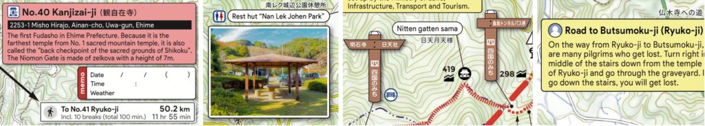
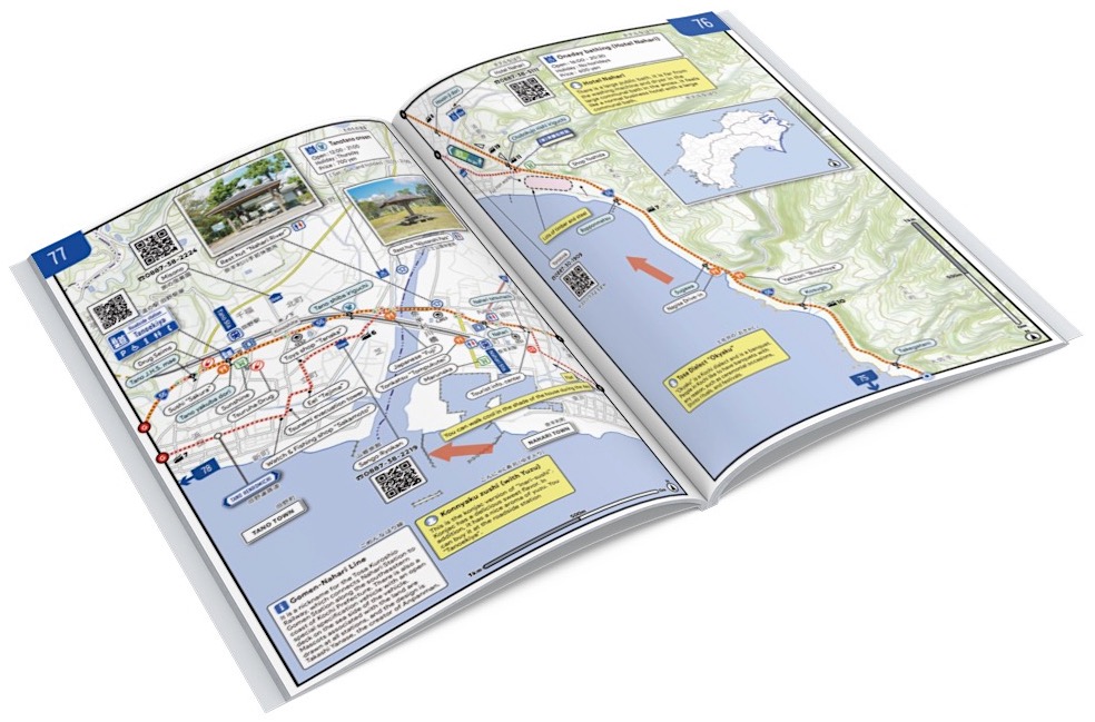
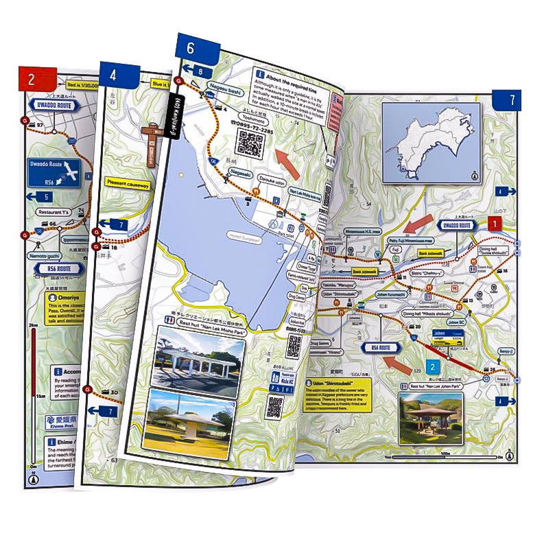
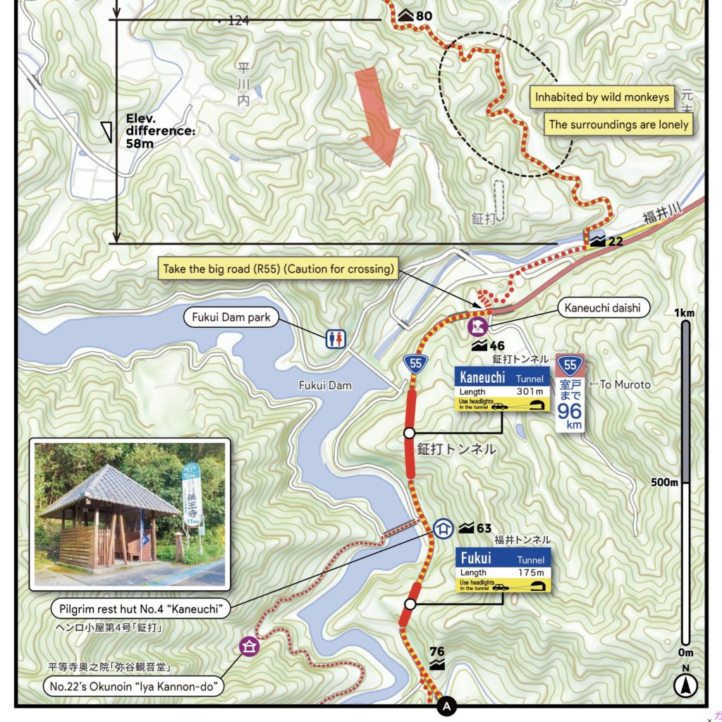
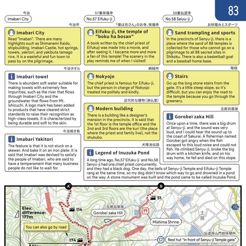
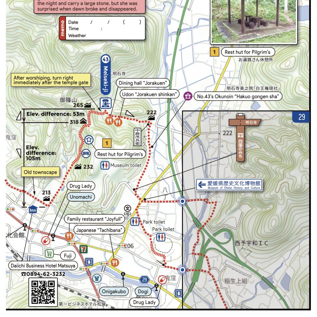
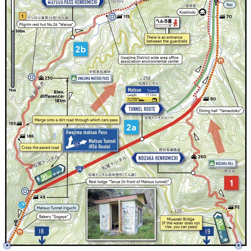
We made a promise to always orient maps with north at the top on every page. The foundational map data is sourced from the Ministry of Land, Infrastructure, Transport and Tourism and the Geospatial Information Authority of Japan’s latest 2023 edition. Through on-site surveys of challenging terrains and complex cityscapes, we provide insights with annotations and illustrations.
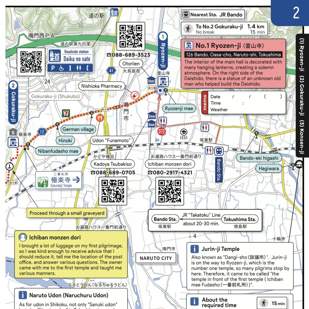
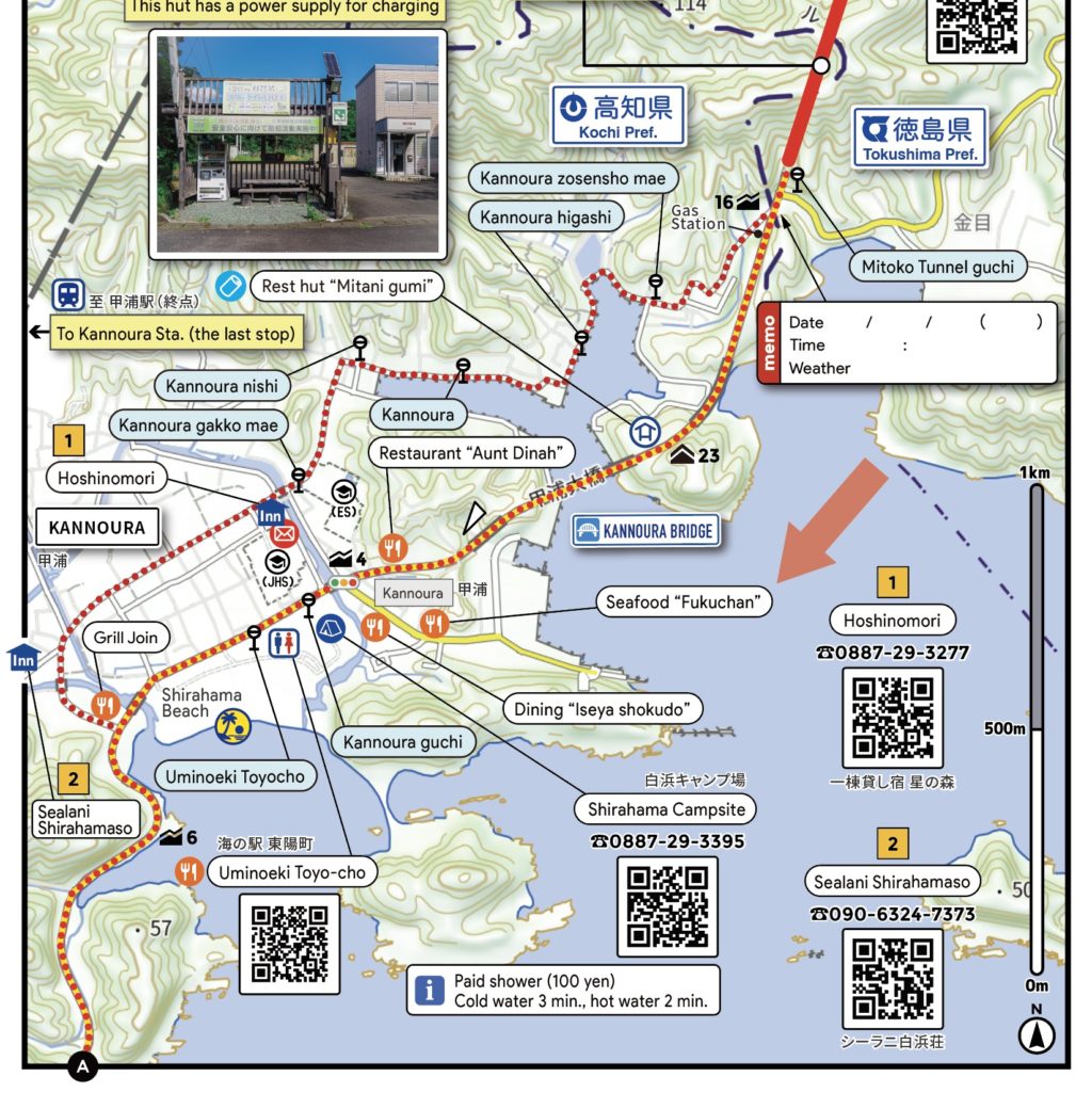
Photographs of Henro Shelters, invaluable for identifying places to seek refuge from the rain or spots to enjoy lunch, include details like the availability of tables. A dedicated space to note down the date, time, and weather upon reaching each temple allows for a moment in time to be revisited whenever you wish.
We ensure that the information on convenience stores, eateries, and accommodations, which frequently open and close, is up to date. Reviews from previous travelers enhance the enjoyment of your journey.
Moreover, the map is packed with beneficial details, including local insights, warnings for easily confusing spots, and sign illustrations, among others. “THE PILGRIMAGE MAP MADE BY EVERYONE” aims to support your journey in collaboration with the entire community.
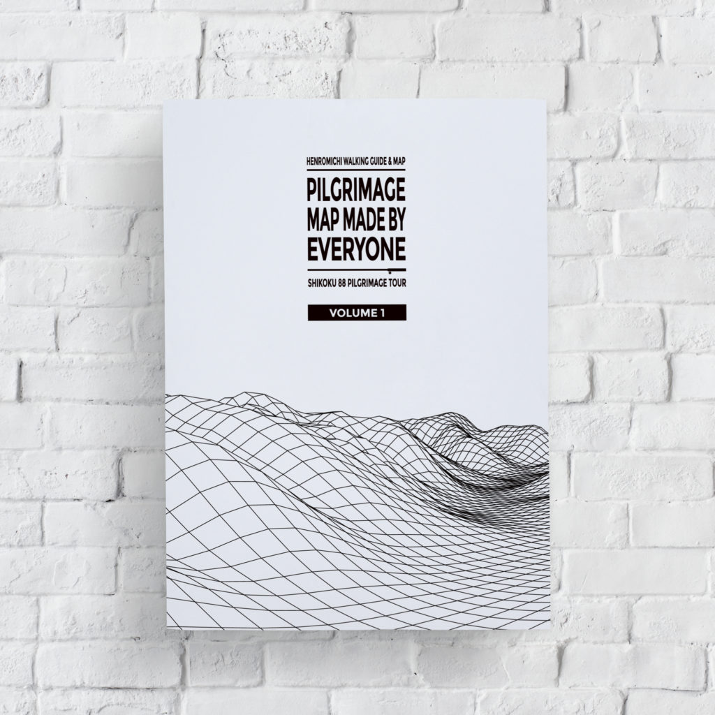
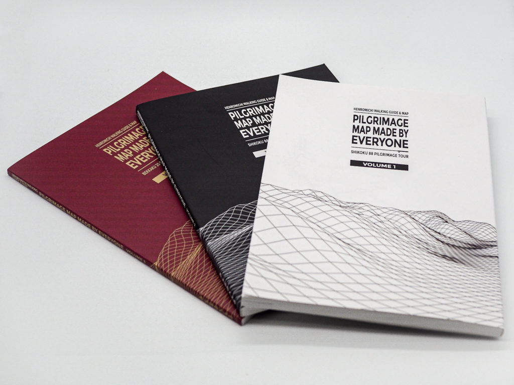
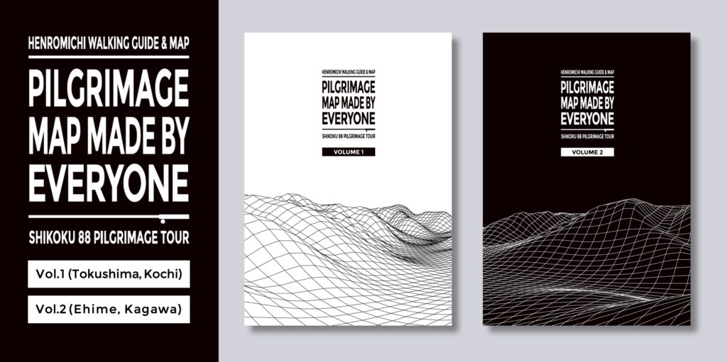
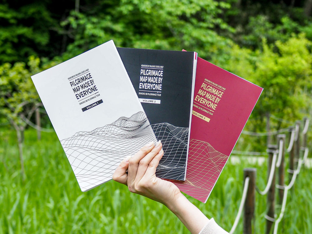
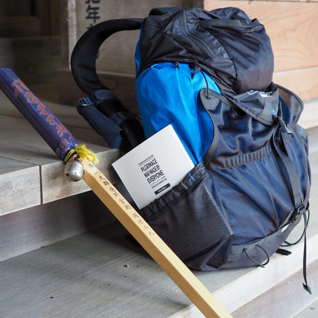
Volume 1: The Tokushima and Kochi Edition.
The journey’s outset is laden with apprehensions about diverging paths and daunting obstacles.
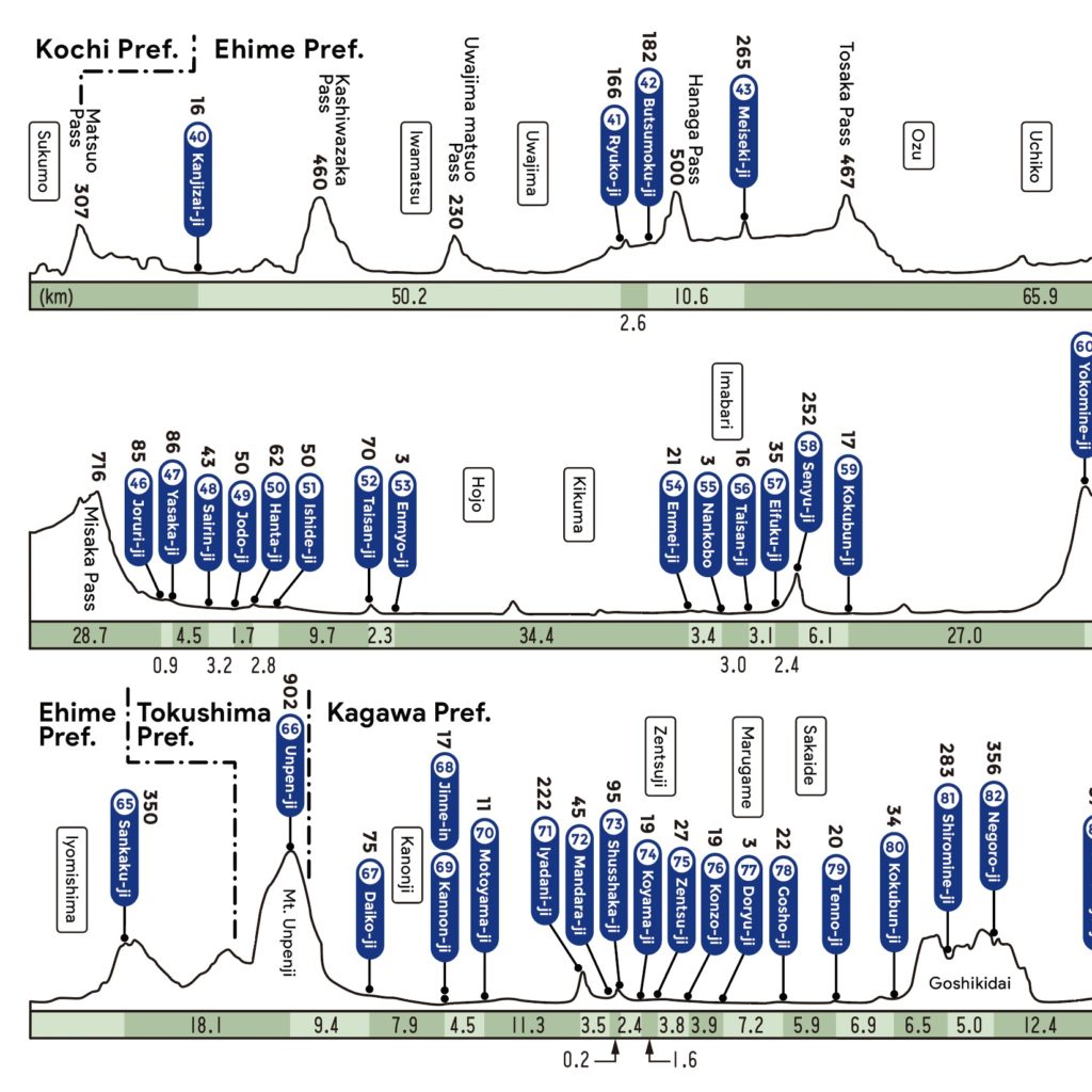
Covering temples No. 1 Ryozen-ji through No. 39 Enko-ji, this volume includes a guide to Tokushima’s three greatest challenges—often referred to as “first Shosan, second Otsuru, third Tairyu”—complete with commentary from actual on-site surveys to alleviate the worries that lie ahead. In Kochi, where the distances between temples are notably vast, the journey becomes more than just a walk. Learning about the breathtaking scenic spots, local history, regional cuisine, and specialty products along the way transforms reaching each destination into an exciting part of the adventure.
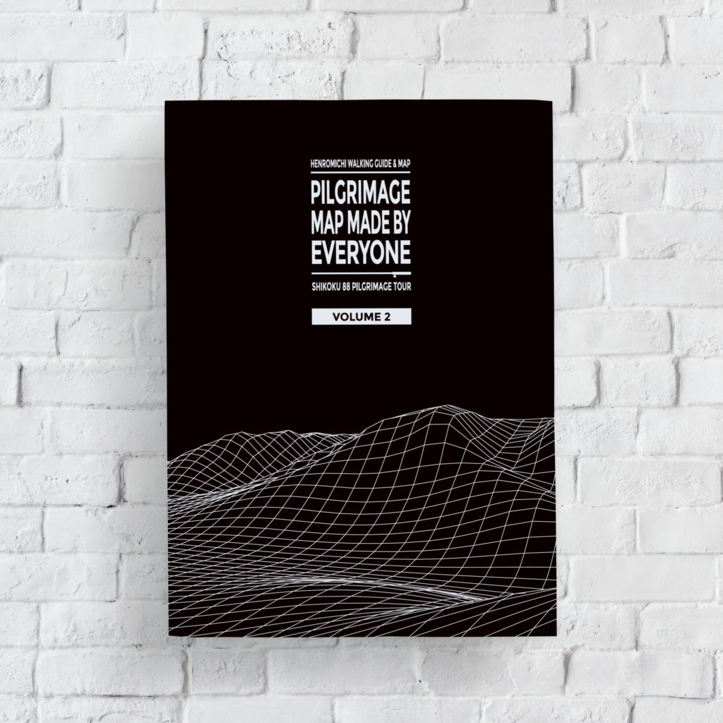
Volume 2: The Ehime and Kagawa Edition.
This book offers peace of mind even as you approach the journey’s climax.
Spanning from Temple No. 40 Kanjizai-ji to No. 88 Okubo-ji, this volume takes you on a transformative journey through the Seto Inland Sea, where the scenery undergoes dramatic changes. After traversing the Kuma-Kogen Plateau, which remains cool even in the summer, you’ll find yourself in the hot spring town of Dogo. The latter half of your pilgrimage is filled with diverse paths, including the challenging Yokomine-ji, the high-altitude Unpen-ji, and Mt. Nyotaizan, each presenting its own set of trials.
Urban areas, surprisingly, are where it’s easiest to lose your way. With careful consideration of the most user-friendly scale, our guide makes navigating from broad avenues to narrow alleyways clear, ensuring you won’t miss a turn.
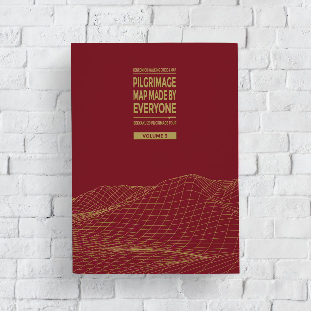
Volume 3: The Special Twenty Sacred Sites Edition.
A detailed map was indeed essential for the Bekkaku.
This volume was created in response to the widespread request for “a map of the Bekkaku next.” Navigating the Bekkaku routes can be particularly challenging due to their complexity and the scarcity of information, presenting a considerable difficulty for beginners. Many believe the essence of the Shikoku Pilgrimage lies in the journey itself, with its paths winding through nature, offering moments of exhilaration amidst the mountains, valleys, and passes. The Bekkaku paths encapsulate these experiences, presenting a level of extraordinariness within the already extraordinary, truly making them special. This book is eagerly anticipated by fans of the Bekkaku, serving as a complementary map to Volumes 1 and 2.
Comprehensive Coverage of Every Facility Type
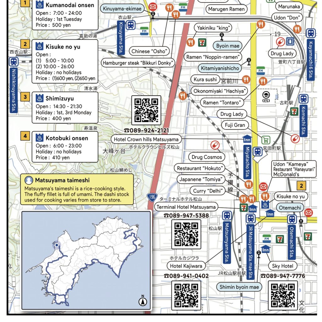
The pilgrimage journey encompasses numerous local amenities. Our guide includes a broad spectrum of facilities tailored to various needs, including pilgrim lodges, eateries, convenience stores, restrooms, pharmacies, post offices, coin laundries, public baths, and roadside stations. For instance, the range of pilgrim accommodations spans from traditional inns with a long history to temple lodgings (shukubo), business hotels, and contemporary guesthouses. Public baths offer details on operational hours, regular closures, and fees, ensuring you’re equipped with the most current information, especially for fast-changing venues like convenience stores.

“Always North Up” Among Other Requests:
Loaded with Pilgrimage Enthusiasts’ Feedback from Across the Nation
In the process of creating this map, we conducted a preliminary survey to understand exactly what type of map users desired. Questions covered a range of topics, from specific dissatisfactions to desired content and preferred book size. Responses included a variety of specific requests, such as “North must always be at the top,” “Locations of public toilets,” “Photographs of rest areas,” “Information on road gradients and elevation,” “Uniform scale throughout,” “Compact and lightweight design,” and “Larger font size,” among many others. The feedback from individuals who have navigated the pilgrimage themselves was incredibly insightful, reflecting ideas born out of real-life inconveniences and frustrations.
The reviews collected are equally diverse, covering accommodations worth revisiting, memorable interactions with temple priests, recommended eateries, insider temple stories, reflections on navigating challenging paths, as well as humorous anecdotes.
This initiative was about creating the map we all wished we had. By sharing our own trials and triumphs, we aim to guide those embarking on their pilgrimage journey. The result is a map that encapsulates the collective wishes and wisdom of pilgrimage fans nationwide.
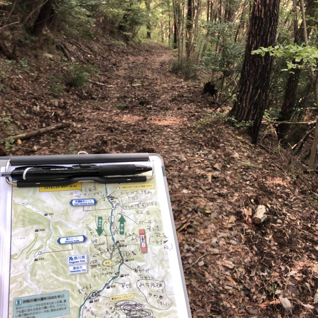
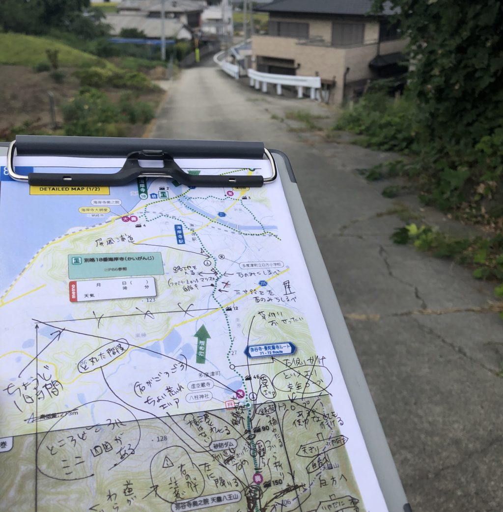
Conducting Field Surveys with Eyes, Feet, and GPS
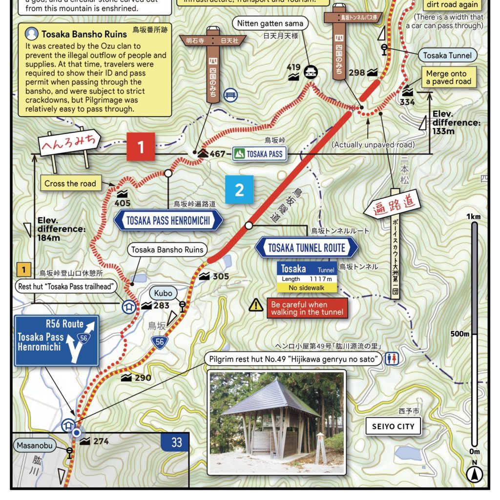
To ensure the provision of highly reliable information, we dedicate substantial time to conducting thorough field surveys for every path. We meticulously verify areas prone to confusion using both visual observations and GPS technology to gather accurate data. This approach allows us to replicate even the most secluded mountain trails with great precision. It’s our uncompromising standard of care to guarantee that every pilgrim can undertake their journey with confidence and enjoyment.
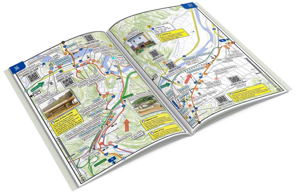
Gallery
(Click to enlarge)

Bridging Print and Digital: Keeping You Updated Online
Each accommodation listed in this book is accompanied by a QR code on its page, allowing for a direct link to additional details with a simple smartphone camera scan. Through this QR code, you can access the “MINNA NO HENRO (Inn)” online database, where you’ll find up-to-date information including the facility’s rates, check-in/out times, photos of the exterior to aid in easy identification, greetings from the owner, reviews from previous visitors, and directions from your current location using GPS, complete with distance and estimated time. This digital integration makes it easy to find accommodations that fit your travel style, whether you’re planning in advance or seeking options while on the go.

Enhancing Your Pilgrimage Experience
We’ve compiled a list of questions frequently asked by our guests to make your journey more enjoyable. Dive into your upcoming pilgrimage adventure with content that’s not only easy to navigate and practical but also filled with unique insights.
Q.Is north always at the top of the page?
Yes, in response to overwhelming requests from nearly all our users, we’ve ensured that north is positioned at the top on every page. The habit of viewing maps with north oriented upwards is so ingrained in our daily map-reading practices that we didn’t consider any alternative layouts.
Q.Are bus stops included in the map?
Yes, responding to numerous requests, we’ve added the locations and names of bus stops starting from the second edition.
Q.Can I find it at a bookstore nearby?
Unfortunately, we apologize, but currently, it is exclusively available through online stores only.
Q.When are you planning the next update or edition of the map?
Currently, the timeline is not set, but we anticipate that within two to three years, there could be significant changes such as the opening, closing, or relocation of facilities, alterations to routes due to natural disasters, and updates to feedback. Consequently, we are not producing the book in large quantities. We will proceed to plan for the next edition based on our stock levels and on an as-needed basis. Please note that there may not be reprints or restocks until the next update, and we ask for your understanding if the book sells out.
Thank you for your purchasing!
みんなでつくった遍路地図(下巻)&手拭い 届きましたー!!上下📚揃った!
— ☆りんりん☆ (@rinrin_358) March 15, 2022
子供の頃に遊んだお寺さんや遍路道が詳しく載ってて嬉しい😊✨タケさんありがとうございます!
さぁ!お遍路計画するかな👣😎 https://t.co/31MUQLXiDr pic.twitter.com/8RaBfHUAh2
胃の調子と膝の具合から遍路を諦めようかと考えていたが、地図買ってしまったら居ても立っても居られない。 pic.twitter.com/hEGCxAiYGx
— ヒロミ改めレスタト (@hurotaro) March 17, 2022
家帰ったらみんなでつくった遍路地図届いてた pic.twitter.com/hmuhYNeZAN
— Yohei (@YoheiKato777) November 16, 2021
Embark on an Unforgettable Pilgrimage Journey with a Trusted Map
■ Key Features of This Map
- North is consistently positioned at the top across all pages.
- Reviews of highly recommended accommodations and eateries.
- A dedicated section for noting down Fudasho visit dates, times, and weather conditions.
- QR codes for accommodations to access up-to-date information with your smartphone.
- Visuals of henro shelters and rest spots.
- Differentiation between paved and unpaved paths based on field surveys.
- Guides to route difficulty and current conditions.
- Slope indicators and elevation data to visually represent terrain changes.
- Locations of train stations, bus stops, ferries, and ropeways.
- Estimated walking times to the next temple.
- “Kilometers left” indicators along the route.
- Listings of eateries by name and type of cuisine.
- Details on public baths, including operating hours, days closed, and entrance fees.
- Illustrations of key landmarks for navigational assistance.
- Location of the last vending machine before entering challenging sections.
- An overarching map of Shikoku that tracks your journey.
- The most recent edition of the map for 2023, with a main scale of 1/15,000.
- Designed in an A5 format for ease of reading and portability.
- And more.
■Special Notices
- Volume 1 covers Tokushima to Kochi, while Volume 2 spans Ehime to Kagawa.
- Volume 3 is dedicated to the Shikoku Bekkaku (Special) 20 Sacred Sites.
- Designed specifically for walking pilgrims, this map includes details on back alleys, unpaved Henro paths, and pedestrian-only trails.
- The Shin-Shikoku Mandala Sacred Sites are not featured.
- This publication is a rare find, not available in general bookstores.
■Specifications
- Volume 1: A5 size, full color, 160 pages (bound on the right) / Weight: 215g (Published: Spring 2023, 2nd Edition)
- Volume 2: A5 size, full color, 160 pages (bound on the left) / Weight: 215g (Published: Spring 2023, 2nd Edition)
- Volume 3: A5 size, full color, 100 pages (bound on the left) / Weight: 140g (Published: Spring 2023, 1st Edition)
Volume 1 and Volume 2 ….. 2,200 yen each
Volume 3 ….. 1,100 yen (All tax included)
The Pilgrimage Map Everyone Has Been Waiting For.